Graham reports back from Friends of Scholes Park meeting
Cheadle and Gatley Liberal Democrats
Demand more Learn more
Graham reports back from Friends of Scholes Park meeting
Gatley's Lucy Boxes
Sign up for weekly emails
See crime levels in your postcode area
by Lib Dem Team on 26 August, 2016
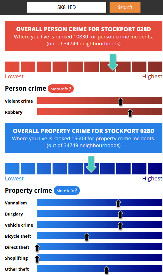
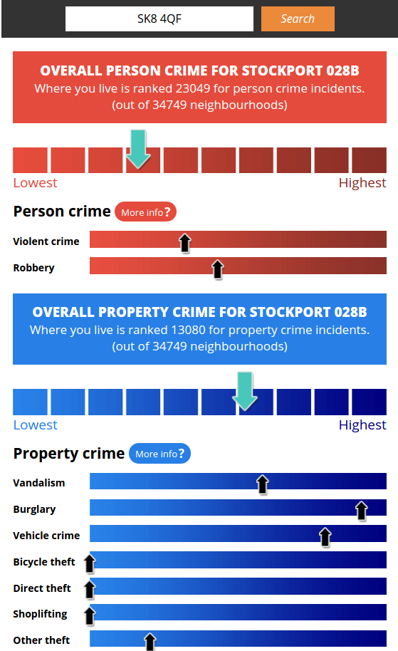
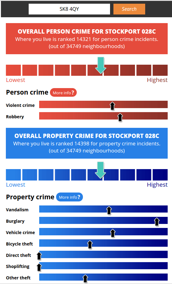
The MEN have brought out a nice tool that allows you to compare crime in your postcode area to the rest of the country – you can try it here.
Here are a few examples:
The Pendlebury Road area in Gatley
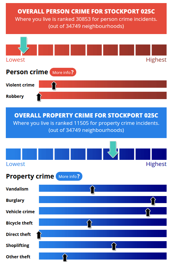
Crime in Pendlebury Road area
Oak Road area in Cheadle
Crime in Oak Road area
Foxland/Delamere/Torkington area in Gatley
Crime in Foxland/Delamere/Torkington area, Gatley
Wensley Road area in Cheadle
Crime in Wensley Road area, Cheadle
What are the areas?
When you get crime figures like this, it’s not the figures for your road but for the area around it. It’s based on something called a Local layer Super Output Area – which is used by Government statisticians.
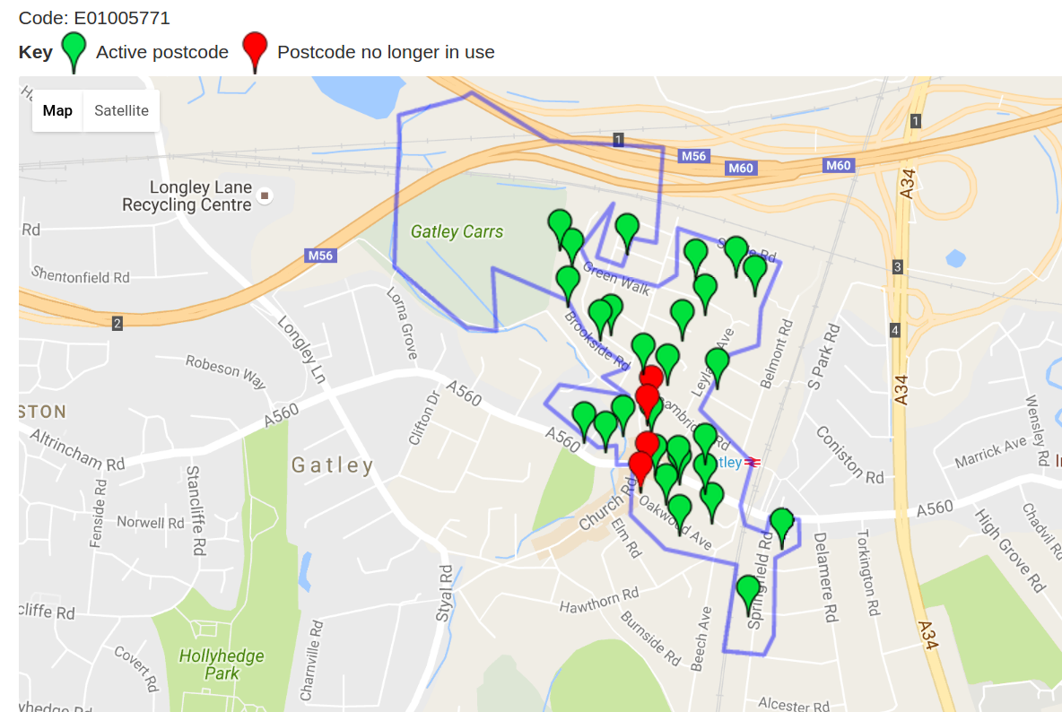
Say you want to know what the Pendlebury Road area covers – that’s given on the MEN website as “Stockport 025C”. So you can Google “Stockport 025C lsoa” and there’s a site called doogal.co.uk which will show you a map that looks something like this.
Thank you it’s a good thing to find out. Pleasantly surprised at Pend. Rd area. All the villains must be scared of you
Ian Roberts. ?